
Bureau Wijkwiskunde ('Cummunity Calculus') sprouted from the collaboration between two anthropologists and a graphic designer. Together we developed an innovative method to ‘map’ socio-spatial problems in urban areas, combining anthropological and visual methods to collect, analyze and present data. Through these maps we identify potential entry points for improving the social wellbeing, image, identity or physical appearance of particular localities, be it an entire neighborhood, a square, park or street.
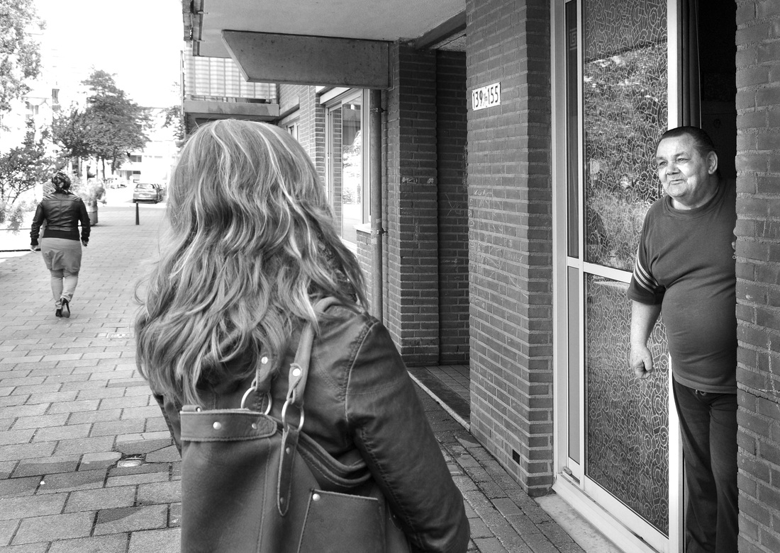
We apply classical anthropological research approaches such as field observations and qualitative interviewing to acquire bottom-up insights into the perspectives of relevant stakeholders such as residents, social welfare institutes, commercial entrepreneurs and policy makers. By bringing into focus these multilayered perspectives on shared topics of concern, we often act as a bridge between these various stakeholders.
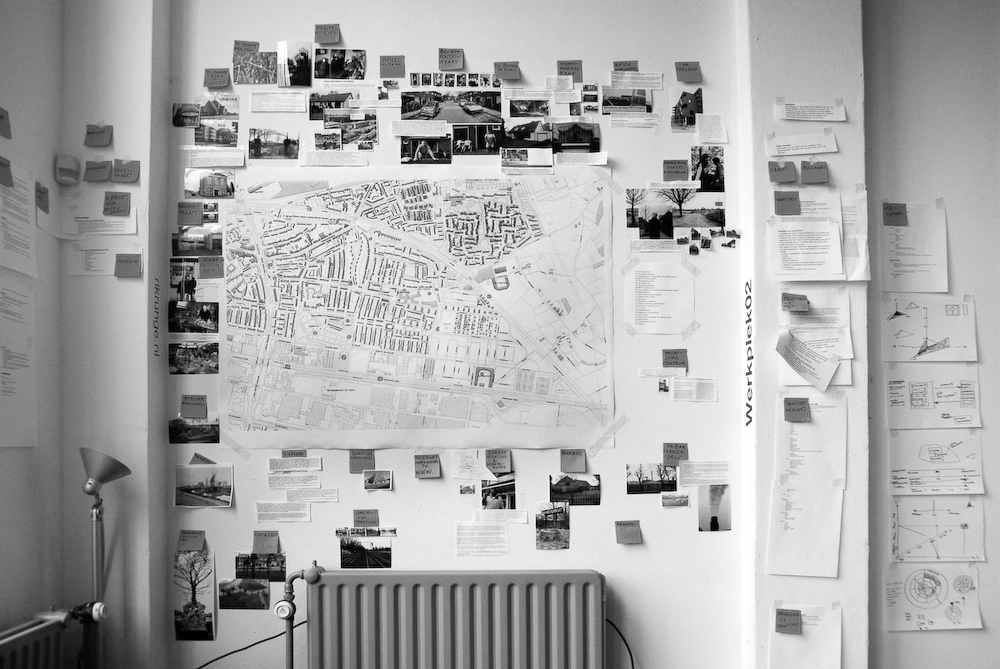
We provide our clients, which include municipalities, social welfare institutes and housing corporations, with policy recommendations, but prefer not to stop there. In also develop and implement creative solutions to address identified issues of concern. Our products therefore vary from interactive maps to shakebikes and a collective 'DNA-wall' with home adornments. Check out our website www.wijkwiskunde.nl for more examples!
We apply classical anthropological research approaches such as field observations and qualitative interviewing to acquire bottom-up insights into the perspectives of relevant stakeholders such as residents, social welfare institutes, commercial entrepreneurs and policy makers. By bringing into focus these multilayered perspectives on shared topics of concern, we often act as a bridge between these various stakeholders.
We provide our clients, which include municipalities, social welfare institutes and housing corporations, with policy recommendations, but prefer not to stop there. In also develop and implement creative solutions to address identified issues of concern. Our products therefore vary from interactive maps to shakebikes and a collective 'DNA-wall' with home adornments. Check out our website www.wijkwiskunde.nl for more examples!
|
APPROACH:
Anthropologic research // study of literature // observation in the district // field work // street interviews in the district. |
|
|
PRODUCT:
Arranging the data // setting forth methodology // visualisation. |
|
|
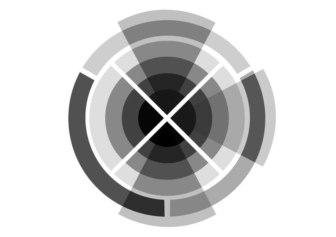
SCTV SYMBOL:
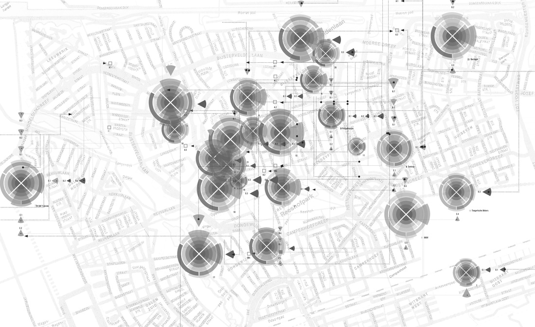
SCALE LEVELS: Individual, Street, District, City. CORNERSTONES: Economy, Social, Physical, Culture. TIME: Past, Present, Future. VIEWPOINTS: Policy, Observation, Experience. |
|
|
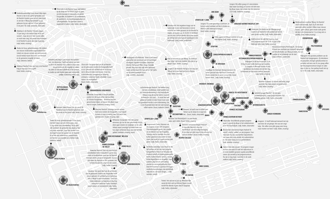
FILLING IN THE SYSTEM:
Filtering significant information by anchor point: at differing levels of scale, from various points of view, at various times. A physical anchor point provides an entry into the system to make it work. |
|
|
DISTRICT AS A SYSTEM:
Our way of looking at a district is to view it as a system. Our way of looking at the identity of a district (the system) is to compare it to a person and an organization. Connections between elements, anchor points and looking at identity produce new insights. |
|
|
CONCLUSION:
A district can be viewed as a system = tool. Identity is based on the past, and manifests itself in the present. For a transition to become possible one has to connect with what is and was. Identity is not static -identity is dynamic. |
|